
Home
Beechwalde Cont’d #2
Compare these two images of this wooden structure located somewhere on Beechwold property as the property was being subdivided into a housing development. You can click on the thumbnails to see them in a larger format.
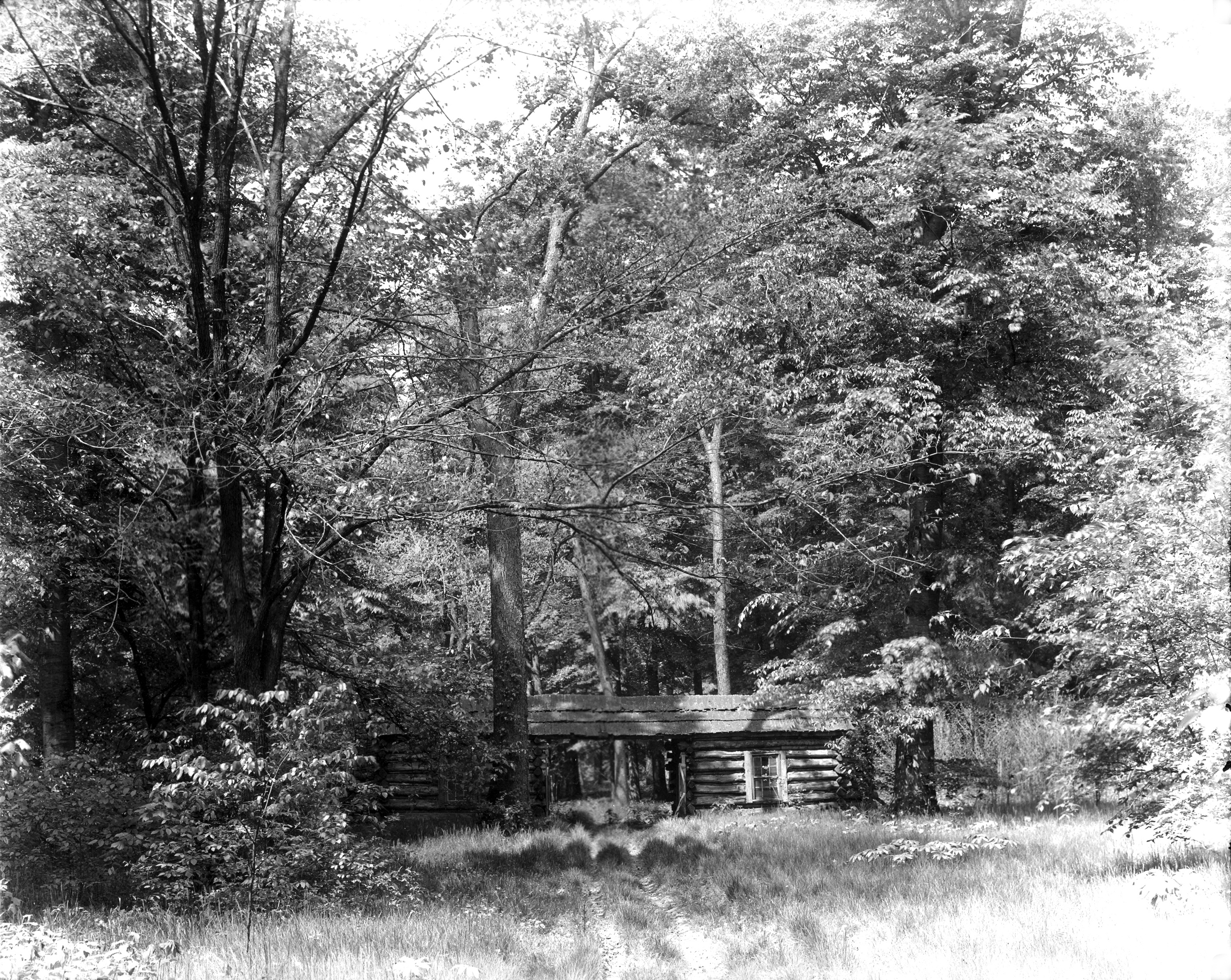 The first photograph shows tire tracks driving right up to the opening between the two sections of the structure. In that photo there are window panes in the windows, and the structure is surrounded by brush and foliage.
 In the second photo, the windows and the foliage are gone. A different photo of the structure during this era is found in my book, Clintonville and Beechwold.
I have been unable to find anyone who remembers the structure first-hand. (The first photo is courtesy of Karen Sweigart Longava; the second photo courtesy of Amy Westervelt.)
Beechwalde Cont’d #3
Compare this watercolor from the promotional brochure for Beechwold, Beechwold the Beautiful, to the image found in my book, Clintonville and Beechwold, on page 26. (Image courtesy of Karen Sweigart Longava.)

Columbus General Hospital
 In 1915, there were plans to build a hospital on the corner of Indianola and Olentangy Avenue adjacent to Glen Echo Park. The hospital would cost a quarter of a million dollars and would include several buildings: surgical, medical, maternity, contagious, laboratory, power plant, and nurses’ home. It was to be called Columbus General Hospital and was an outgrowth of Lawrence Hospitals. The goal was to take care of the needs of the rapidly growing north side.
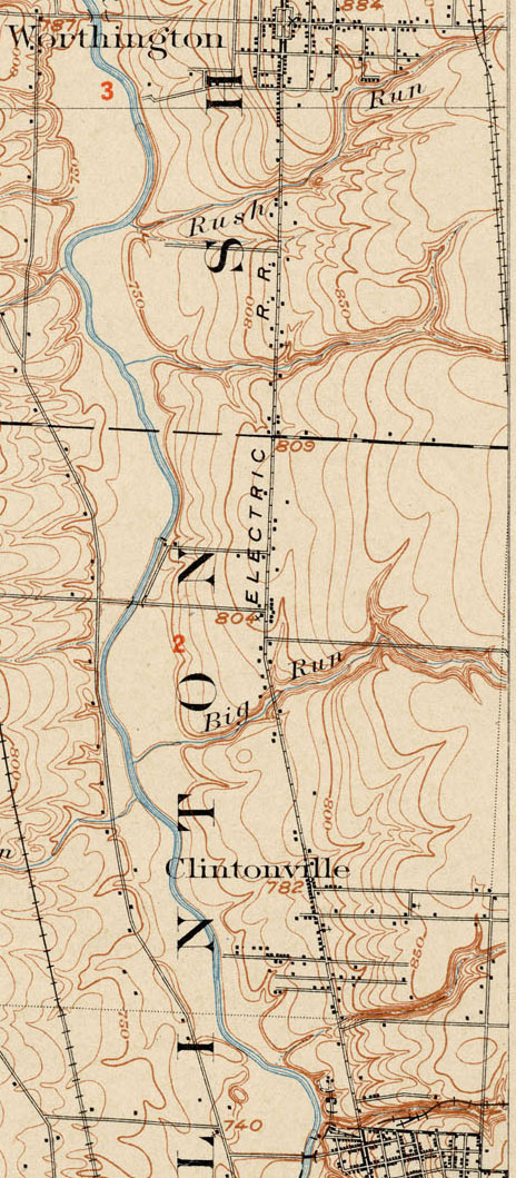
Topographic Map, 1903
This 1903 topographic map shows the road configuration of the intersection of East North Broadway and High Streets. To orient yourself, remember that there were no bridges across the Olentangy River between Dodridge and Henderson, so Dodridge is the southern bridge and Henderson next bridge north of that. Calumet Street did not exist, and many other side streets had as yet to be developed, or were called by different names than they are today.
Toll House
The Worthington Pike, now called High Street, was supported by funds collected from a toll gate which was located opposite from Olentangy Park. The gate was operated by the Applican family, parents of Mrs. N. E. McCoy. The pole was let down each night and not opened until 4:00 a.m. Dr. Albert Cooper was the North Columbus physician at that time. If he had gone north on a call. the toll keeper always waited up for him or else was roused from his sleep in the night to raise the pole and let the doctor pass through on his homeward trip. –from an old undated newspaper clipping
Baist’s Atlas
One of my favorite maps is this one from Baist’s Atlas, produced around 1920. Someone sent it to me while I was working on my book. Note that North High School had not yet been built on Arcadia.